ZCZC MIATWOEP ALL
TTAA00 KNHC DDHHMM
Tropical Weather Outlook
NWS National Hurricane Center Miami FL
1100 AM PDT Sat May 30 2020
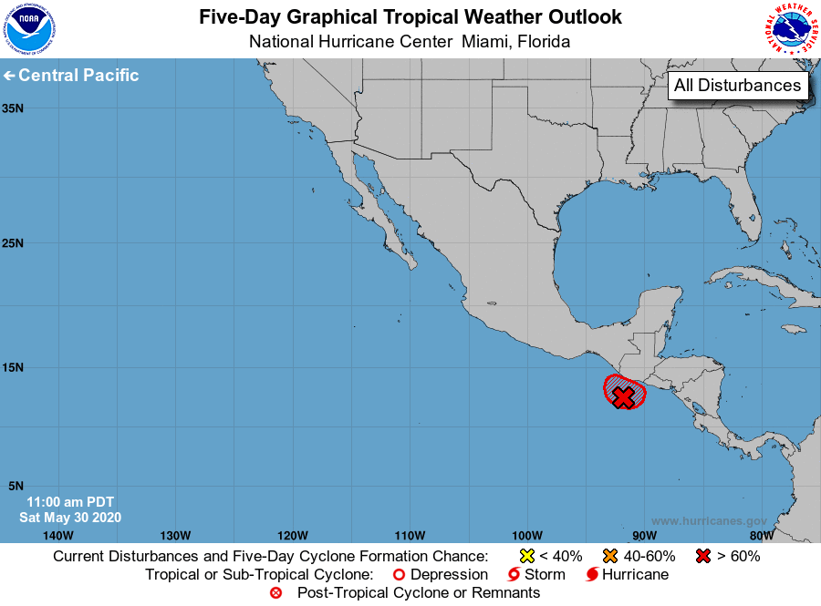
For the eastern North Pacific...east of 140 degrees west longitude:
Satellite images indicate that showers and thunderstorms associated
with the low pressure system located just off the coasts of
Guatemala and El Salvador continue to become better organized. If
the current trend continues, advisories could be initiated on this
system later today or tonight. Interests in El Salvador, Guatemala,
and southern Mexico should closely monitor the progress of this
system as it is expected to move across those locations tonight and
Sunday.
1. Regardless of development, this slow moving disturbance is expected
to produce heavy rainfall over portions of Central America and
southern Mexico during the next few days. These rains could cause
life-threatening flash floods and mudslides, especially in areas of
mountainous terrain. See products from your local national
meteorological service for additional information.
* Formation chance through 48 hours...high...80 percent.
* Formation chance through 5 days...high...80 percent.
Forecaster Cangialosi