ZCZC MIATWOEP ALL
TTAA00 KNHC DDHHMM
Special Tropical Weather Outlook
NWS National Hurricane Center Miami FL
640 PM PDT Fri Apr 24 2020
For the eastern North Pacific...east of 140 degrees west longitude:
Special Outlook issued to update discussion on the low pressure area
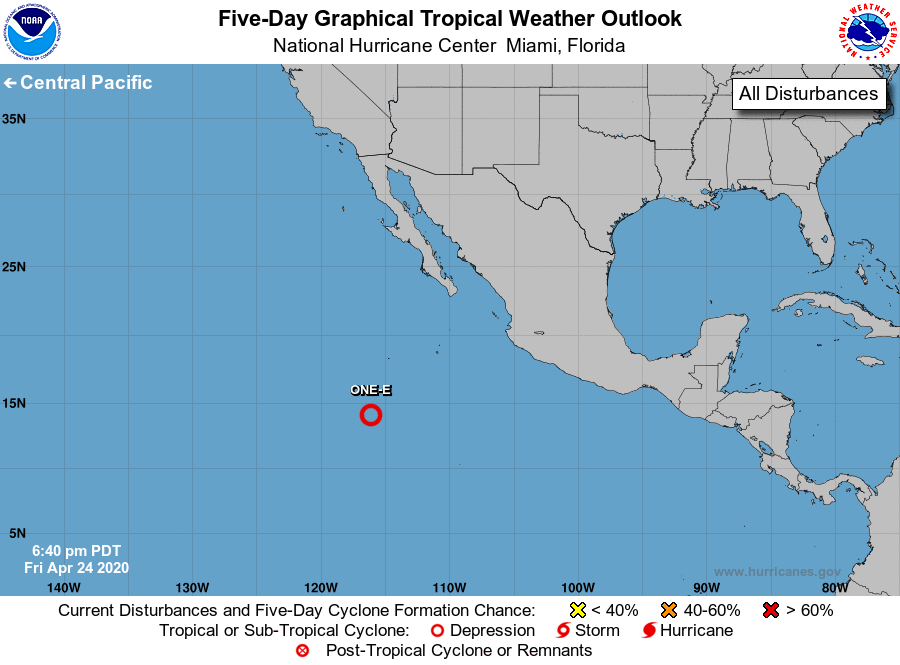
located well south-southwest of Baja California Sur.
1. Showers and thunderstorms associated with a broad area of low
pressure located about 800 miles south-southwest of the southern
tip of Baja California Sur have changed little in organization
today. Environmental conditions are forecast to be conducive for
further development, and a tropical depression is likely to form
during the next day or so while the system moves northwestward at
around 10 mph. By Sunday, upper-level winds should become
unfavorable for development. The next Special Tropical Weather
Outlook on this system will be issued by 8 AM PDT Saturday, or
earlier, if necessary.
* Formation chance through 48 hours...high...80 percent.
* Formation chance through 5 days...high...80 percent.
Forecaster Blake