ZCZC MIATWOEP ALL
TTAA00 KNHC DDHHMM
Special Tropical Weather Outlook
NWS National Hurricane Center Miami FL
645 PM PDT Thu Apr 23 2020
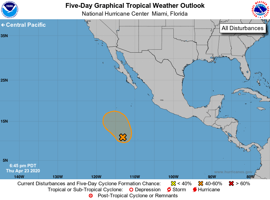
For the eastern North Pacific...east of 140 degrees west longitude:
Special Tropical Weather Outlook issued to discuss the area of
disturbed weather located well south-southwest of the southern tip
of the Baja California Peninsula.
1. Shower and thunderstorm activity has become a little better
organized today in association with a broad area of low pressure
located about 900 miles south-southwest of the southern tip of the
Baja California Peninsula. Environmental conditions are favorable
for some gradual development, and a tropical depression could form
in the next day or two as the system moves slowly northwestward. By
late this weekend, conditions will become less conducive for
development. The next Special Tropical Weather Outlook on this
system will be issued by 8 AM PDT Friday, or earlier, if necessary.
* Formation chance through 48 hours...medium...50 percent.
* Formation chance through 5 days...medium...50 percent.
Forecaster Brennan