ZCZC MIATWOEP ALL
TTAA00 KNHC DDHHMM
Special Tropical Weather Outlook
NWS National Hurricane Center Miami FL
705 AM PDT Thu Apr 23 2020
For the eastern North Pacific...east of 140 degrees west longitude:
Special Tropical Weather Outlook issued to discuss the area of
disturbed weather located several hundred miles south of the
southern tip of the Baja California Peninsula.
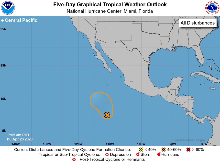
1. 1. A large area of disturbed weather associated with a trough of
low pressure has formed several hundred miles south of the
southern tip of the Baja California peninsula. Environmental
conditions are favorable for some gradual development for the next
couple of days as the disturbance moves slowly northwestward. By
late this weekend, conditions will become less conducive for
development. The next Special Tropical Weather Outlook on this
system will be issued by 2 PM PDT Friday, or earlier, if necessary.
* Formation chance through 48 hours...low...30 percent.
* Formation chance through 5 days...medium...40 percent.
Forecaster Latto/Brown