ZCZC MIATWOEP ALL
TTAA00 KNHC DDHHMM
Tropical Weather Outlook
NWS National Hurricane Center Miami FL
400 PM PST Wed Nov 13 2019
For the eastern North Pacific...east of 140 degrees west longitude:
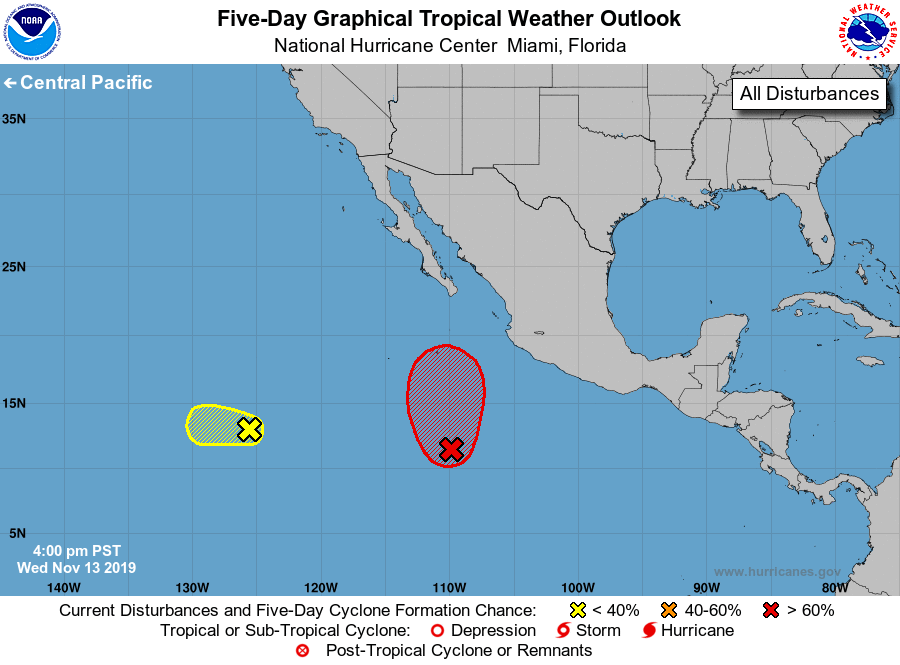
1. A low pressure system located several hundred miles south of the
southern tip of the Baja California peninsula is producing
disorganized cloudiness and showers. Gradual development of the low
is expected during the next several days, and a tropical depression
is likely to form late this week or early this weekend while the
system moves slowly northward.
* Formation chance through 48 hours...medium...60 percent.
* Formation chance through 5 days...high...80 percent.
2. A broad area of low pressure is located several hundred miles
west-southwest of the southern tip of the Baja California peninsula.
Environmental conditions are expected to become increasingly
unfavorable for development of the disturbance while it moves
generally westward at about 10 mph during the next couple of days.
* Formation chance through 48 hours...low...10 percent.
* Formation chance through 5 days...low...10 percent.
Forecaster Zelinsky