ZCZC MIATWOEP ALL
TTAA00 KNHC DDHHMM
Tropical Weather Outlook
NWS National Hurricane Center Miami FL
1100 AM PDT Sun Oct 20 2019
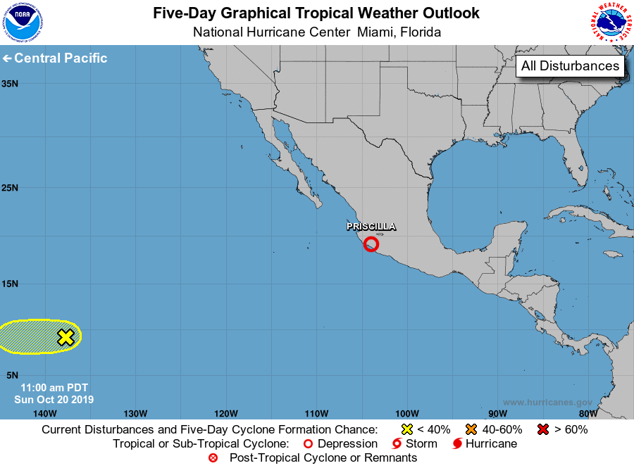
For the eastern North Pacific...east of 140 degrees west longitude:
The National Hurricane Center is issuing advisories on Tropical
Storm Priscilla, located less than a hundred miles south-southeast
of Manzanillo, Mexico.
1. A small area of low pressure located more than a thousand miles
east-southeast of the Hawaiian Islands continues to produce
disorganized showers and thunderstorms. Any development should be
slow to occur while this system moves slowly westward at 5 to 10
mph during the next couple of days. This system is expected
to move into the central Pacific basin by tonight or early Monday.
* Formation chance through 48 hours...low...20 percent.
* Formation chance through 5 days...low...20 percent.
Public Advisories on Priscilla are issued under WMO header WTPZ34
KNHC and under AWIPS header MIATCPEP4. Forecast/Advisories on
Priscilla are issued under WMO header WTPZ24 KNHC and under AWIPS
header MIATCMEP4.
Forecaster Berg