ZCZC MIATWOEP ALL
TTAA00 KNHC DDHHMM
Tropical Weather Outlook
NWS National Hurricane Center Miami FL
500 AM PDT Wed Oct 16 2019
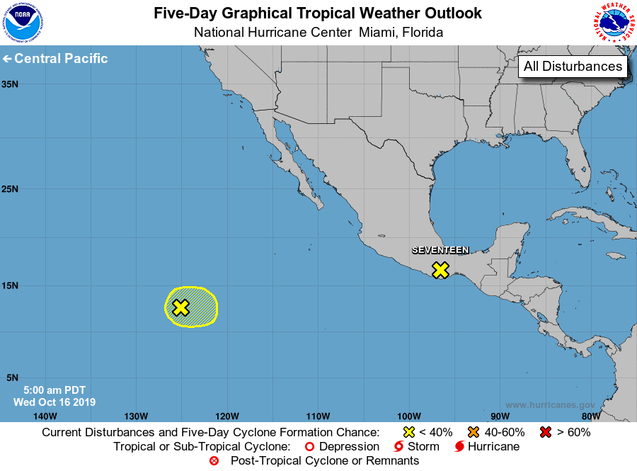
For the eastern North Pacific...east of 140 degrees west longitude:
The National Hurricane Center is issuing advisories on Potential
Tropical Cyclone Seventeen-E, located near the southern coast of the
state of Oaxaca, Mexico.
* Formation chance through 48 hours...high...90 percent.
* Formation chance through 5 days...high...90 percent.
1. A large area of disorganized showers and thunderstorms located about
1200 miles southwest of the southern tip of the Baja California
peninsula is associated with a trough of low pressure.
Environmental conditions could support some gradual development of
this system during the next few days while the system moves little.
* Formation chance through 48 hours...low...10 percent.
* Formation chance through 5 days...low...30 percent.
Public Advisories on Seventeen-E are issued under WMO header
WTPZ32 KNHC and under AWIPS header MIATCPEP2. Forecast/Advisories
are issued under WMO header WTPZ22 KNHC and under AWIPS header
MIATCMEP2.
Forecaster Roberts