Skip Navigation Links
NOAA NOAA United States Department of Commerce

NHC Graphical Outlook Archive


« Earliest Available         ‹ Earlier         Later ›         Latest Available »
GIS Shapefiles
Central Pacific Eastern Pacific Atlantic

View 2-Day Graphical Tropical Weather Outlook
Click for Atlantic Click for Atlantic

Tropical Weather Outlook Text

ZCZC MIATWOEP ALL
TTAA00 KNHC DDHHMM

Tropical Weather Outlook
NWS National Hurricane Center Miami FL
1100 PM PDT Tue Oct 1 2019

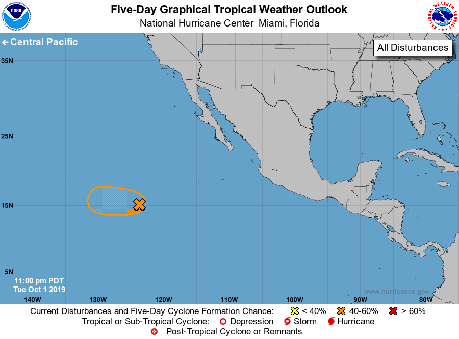
For the eastern North Pacific...east of 140 degrees west longitude:

1. A low pressure system, located a little over 1000 miles southwest of
the southern tip of the Baja California peninsula, is producing
disorganized showers and thunderstorms.  Gradual development of this
system is possible during the next several days, and a tropical
depression could form over the weekend while the system moves slowly
westward.
* Formation chance through 48 hours...low...20 percent.
* Formation chance through 5 days...medium...40 percent.

Forecaster Roberts


List of Atlantic Outlooks (May 2023 - present)
List of East Pacific Outlooks (May 2023 - present)
List of Central Pacific Outlooks (May 2023 - present)
List of Atlantic Outlooks (July 2014 - April 2023)
List of East Pacific Outlooks (July 2014 - April 2023)
List of Central Pacific Outlooks (June 2019 - April 2023)
List of Atlantic Outlooks (June 2009 - June 2014)
List of East Pacific Outlooks (June 2009 - June 2014)