ZCZC MIATWOEP ALL
TTAA00 KNHC DDHHMM
Tropical Weather Outlook
NWS National Hurricane Center Miami FL
1100 PM PDT Fri Sep 27 2019
For the eastern North Pacific...east of 140 degrees west longitude:
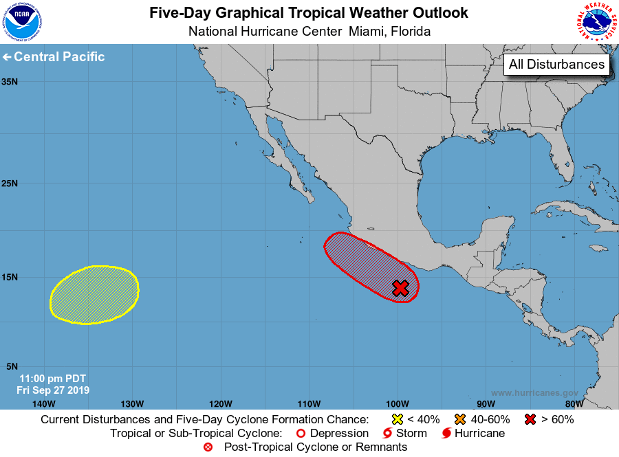
1. A large area of disturbed weather extends from Central America
westward along the southwest coast of Mexico. This system is
gradually becoming better organized, however, it does not appear to
have a well-defined circulation at this time. Development is
anticipated and a tropical depression or tropical storm will likely
form during the next day or so while the system moves
west-northwestward to northwestward at 10 to 15 mph, near the
southwestern coast of Mexico. Interests along that portion of the
coast should monitor the progress of this disturbance since tropical
storm watches or warnings could be required on Saturday. Regardless
of development, heavy rainfall, with the possibility of flash
flooding and mudslides, is expected near the southwestern coast of
Mexico during the next few days. For information on potential marine
hazards, see High Seas forecasts issued by the National Weather
Service.
* Formation chance through 48 hours...high...90 percent.
* Formation chance through 5 days...high...90 percent.
2. An area of low pressure is expected form over the far southwestern
portion of the eastern North Pacific early next week. Some gradual
development is possible thereafter while the system drifts slowly
eastward or northeastward.
* Formation chance through 48 hours...low...near 0 percent.
* Formation chance through 5 days...low...30 percent.
High Seas Forecasts issued by the National Weather Service
can be found under AWIPS header NFDHSFEPI, WMO header FZPN02
KWBC, and on the web at ocean.weather.gov/shtml/NFDHSFEPI.php
Forecaster Zelinsky