ZCZC MIATWOEP ALL
TTAA00 KNHC DDHHMM
Tropical Weather Outlook
NWS National Hurricane Center Miami FL
500 PM PDT Thu Sep 26 2019
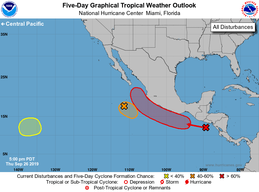
For the eastern North Pacific...east of 140 degrees west longitude:
1. Shower activity is a little better organized than earlier today in
association with a broad area of low pressure located several
hundred miles south-southwest of the southern tip of the Baja
California peninsula. Although upper level winds are expected to
become less conducive for development later tonight, a tropical
depression could still form by Friday night before it becomes
absorbed by a larger weather disturbance near the coast of Mexico
over the weekend.
* Formation chance through 48 hours...medium...40 percent.
* Formation chance through 5 days...medium...40 percent.
2. An elongated trough of low pressure near the coast of southern and
southwestern Mexico is producing a large area of disorganized
showers and thunderstorms. A low is expected to form along this
trough during the next couple of days, and it is likely to become a
tropical depression over the weekend or early next week while it
moves west-northwestward to northwestward at 10 to 15 mph near the
southern and southwestern coasts of Mexico. Regardless of
development, heavy rainfall, with the possibility of flash flooding
and mudslides, is likely along the Pacific coasts of Central America
and southern and southwestern Mexico during the next several days.
* Formation chance through 48 hours...medium...40 percent.
* Formation chance through 5 days...high...80 percent.
3. A low pressure area is expected to form over the weekend in the far
southwestern part of the east Pacific basin. Some subsequent slow
development is possible into early next week as the low moves
slowly eastward.
* Formation chance through 48 hours...low...near 0 percent.
* Formation chance through 5 days...low...30 percent.
Forecaster Latto