ZCZC MIATWOEP ALL
TTAA00 KNHC DDHHMM
Tropical Weather Outlook
NWS National Hurricane Center Miami FL
500 AM PDT Mon Sep 23 2019
For the eastern North Pacific...east of 140 degrees west
longitude:
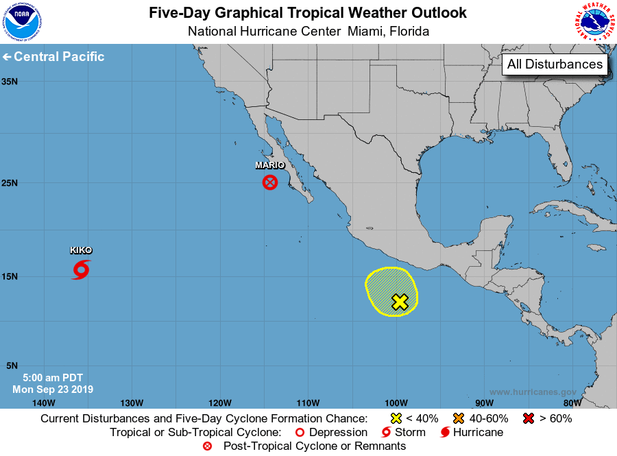
The National Hurricane Center is issuing advisories on Tropical
Depression Mario, located a a little more than 100 miles west of
the southwestern coast of the Baja California peninsula, and on
Tropical Storm Kiko, located over the far southwestern part of
the basin.
1. A small low pressure system located several hundred miles south
of the southwestern coast of Mexico is producing disorganized
showers and thunderstorms. This system is expected to drift
northward or northwestward during the next few days, and
significant development is unlikely due to strong upper-level
winds.
* Formation chance through 48 hours...low...10 percent.
* Formation chance through 5 days...low...10 percent.
Forecaster Zelinsky