ZCZC MIATWOEP ALL
TTAA00 KNHC DDHHMM
Tropical Weather Outlook
NWS National Hurricane Center Miami FL
1100 AM PDT Wed Sep 18 2019
For the eastern North Pacific...east of 140 degrees west longitude:
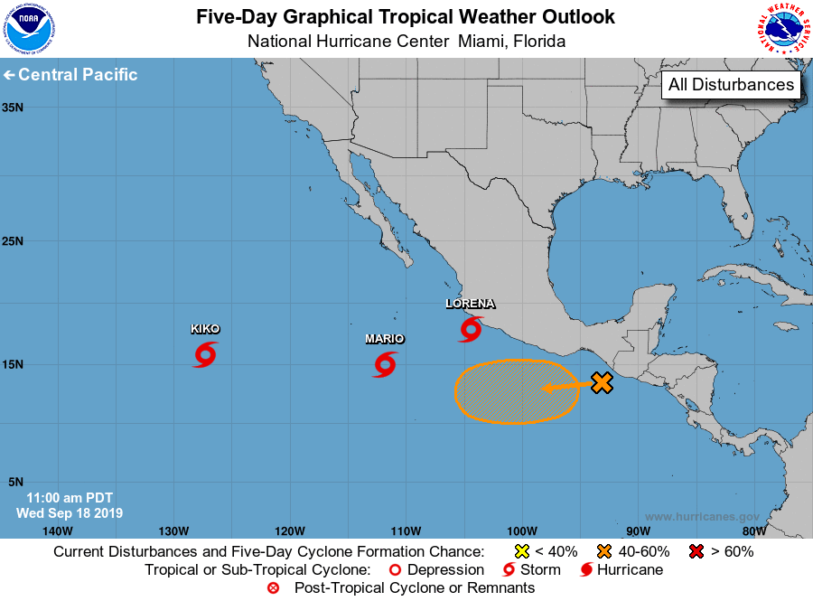
The National Hurricane Center is issuing advisories on Tropical
Storm Kiko, located over the far southwestern part of the basin, on
Tropical Storm Mario, located several hundred miles south of the
southern tip of the Baja California peninsula, and on Tropical Storm
Lorena, located about a hundred miles south of southwestern
Mexico.
1. An elongated trough of low pressure lying near the coast of
southeastern Mexico, Guatemala, and El Salvador is producing a large
area of disorganized cloudiness and showers that extends several
hundred miles southward over the Pacific waters. Gradual
development of this system is possible during the next several days,
and a tropical depression could form over the weekend or early next
week while moving westward at 5 to 10 mph.
* Formation chance through 48 hours...low...near 0 percent.
* Formation chance through 5 days...medium...40 percent.
Forecaster Blake