ZCZC MIATWOEP ALL
TTAA00 KNHC DDHHMM
Tropical Weather Outlook
NWS National Hurricane Center Miami FL
1100 AM PDT Tue Aug 20 2019
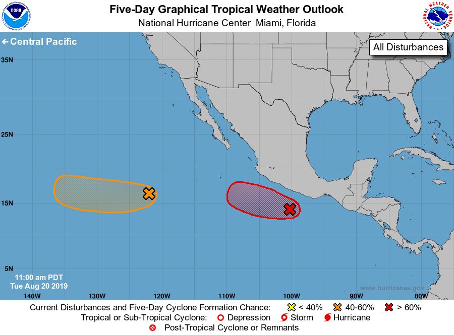
For the eastern North Pacific...east of 140 degrees west longitude:
1. A low pressure system located a couple of hundred miles south of the
southern coast of Mexico continues to produce a large area of
cloudiness and thunderstorms. Although this system has not become
better organized since yesterday, environmental conditions
are conducive for development, and a tropical depression is likely
to form during the next day or so while the low moves west-
northwestward at 10 to 15 mph, parallel to and just offshore of the
coast of Mexico. This system could produce heavy rainfall and flash
flooding over portions of southeastern Mexico during the next couple
of days.
* Formation chance through 48 hours...high...80 percent.
* Formation chance through 5 days...high...90 percent.
2. Another low pressure system located more than 900 miles
west-southwest of the southern tip of the Baja California peninsula
is producing disorganized showers and a few thunderstorms.
Conditions have become less conducive for development, however a
tropical depression could still form within the next couple of days
while the system moves westward to west-northwestward at about 10
mph.
* Formation chance through 48 hours...medium...40 percent.
* Formation chance through 5 days...medium...60 percent.
Forecaster Pasch