ZCZC MIATWOEP ALL
TTAA00 KNHC DDHHMM
Tropical Weather Outlook
NWS National Hurricane Center Miami FL
500 AM PDT Thu Aug 15 2019
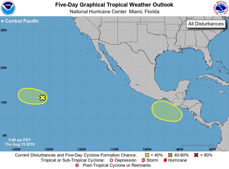
For the eastern North Pacific...east of 140 degrees west longitude:
1. An elongated area of low pressure located about 1500 miles
west-southwest of the southern tip of the Baja California peninsula
is producing limited shower activity. Environmental conditions do
not appear conducive for significant development of this system
while it moves westward at 10 to 15 mph during the next couple of
days.
* Formation chance through 48 hours...low...10 percent.
* Formation chance through 5 days...low...10 percent.
2. An area of low pressure is forecast to form south of the coasts of
El Salvador, Guatemala, and southeastern Mexico over the weekend.
Environmental conditions are expected to be conducive for gradual
development of the low while it moves slowly westward early
next week.
* Formation chance through 48 hours...low...near 0 percent.
* Formation chance through 5 days...low...30 percent.
Forecaster Berg