ZCZC MIATWOEP ALL
TTAA00 KNHC DDHHMM
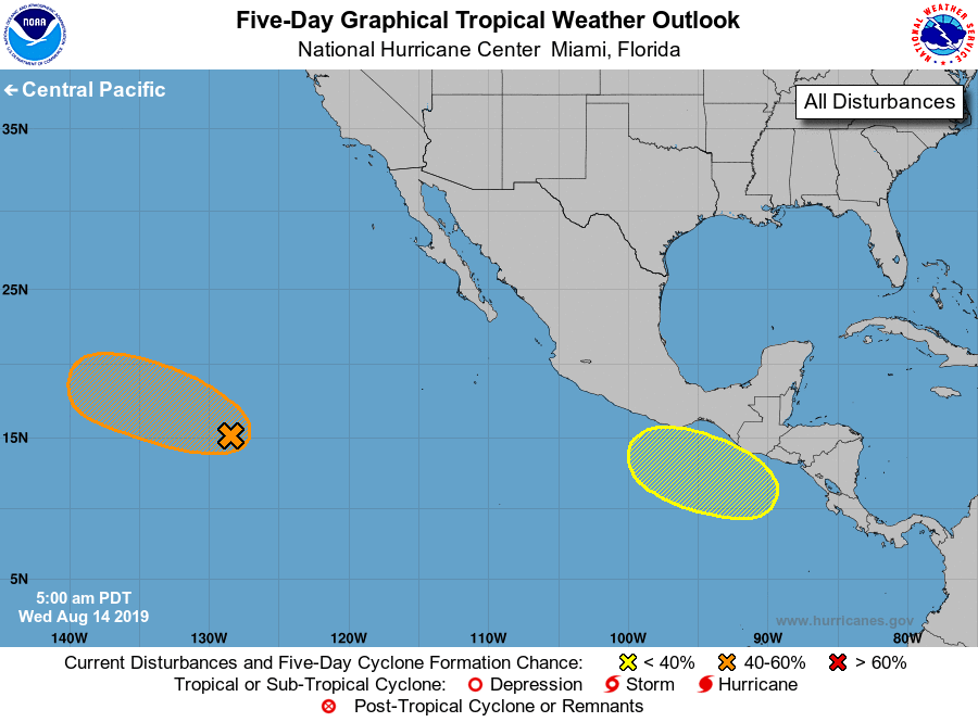
Tropical Weather Outlook
NWS National Hurricane Center Miami FL
500 AM PDT Wed Aug 14 2019
For the eastern North Pacific...east of 140 degrees west longitude:
1. An elongated low pressure system located more than 1300 miles
west-southwest of the southern tip of the Baja California peninsula
is producing a small area of showers and thunderstorms.
Environmental conditions are expected to be somewhat conducive for
development, and a tropical depression could form over the next few
days before the system reaches cooler waters and upper-level winds
become unfavorable. This disturbance is forecast to move
west-northwestward at 10 to 15 mph during the next couple of days.
* Formation chance through 48 hours...medium...40 percent.
* Formation chance through 5 days...medium...50 percent.
2. A broad area of low pressure is forecast to form south or
southeast of the southeastern coast of Mexico late this week.
Environmental conditions are expected to be conducive for gradual
development of the system over the weekend while the system moves
generally westward.
* Formation chance through 48 hours...low...near 0 percent.
* Formation chance through 5 days...low...30 percent.
Forecaster Berg