ZCZC MIATWOEP ALL
TTAA00 KNHC DDHHMM
Tropical Weather Outlook
NWS National Hurricane Center Miami FL
500 AM PDT Mon Aug 12 2019
For the eastern North Pacific...east of 140 degrees west longitude:
The National Hurricane Center is issuing advisories on recently
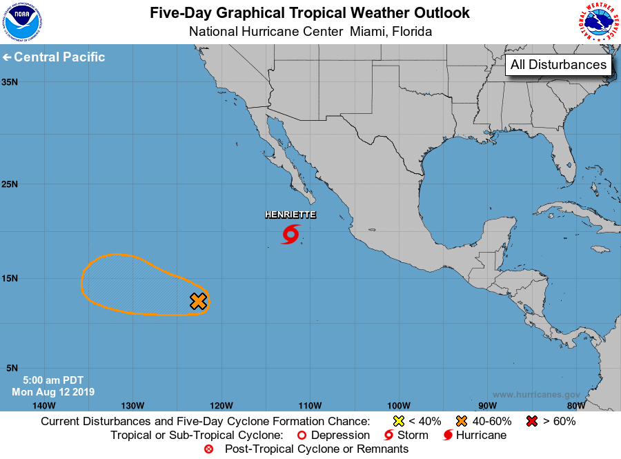
upgraded Tropical Storm Henriette, located a few hundred miles
south-southwest of the southern tip of the Baja California
peninsula.
1. An elongated area of showers and thunderstorms located just over
1000 miles southwest of the southern tip of the Baja California
peninsula is associated with a trough of low pressure. Environmental
conditions are forecast to become more conducive for development
during the next few days, and a tropical depression could form later
this week while the system moves west- northwestward at around 15
mph.
* Formation chance through 48 hours...low...20 percent.
* Formation chance through 5 days...medium...60 percent.
Public Advisories on Tropical Storm Henriette are issued under
WMO header WTPZ34 KNHC and under AWIPS header MIATCPEP4.
Forecast/Advisories on Tropical Storm Henriette are issued
under WMO header WTPZ24 KNHC and under AWIPS header MIATCMEP4.
Forecaster Latto/Pasch