ZCZC MIATWOEP ALL
TTAA00 KNHC DDHHMM
Tropical Weather Outlook
NWS National Hurricane Center Miami FL
500 AM PDT Fri Jul 12 2019
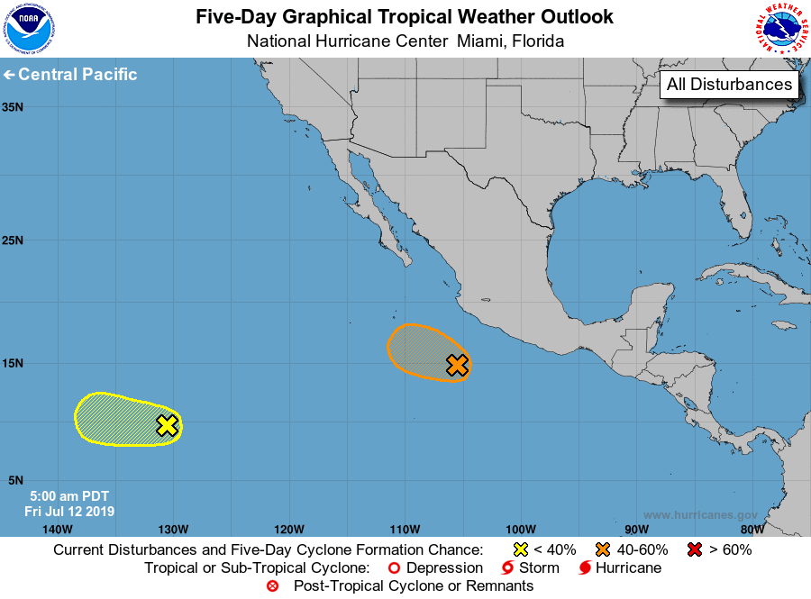
For the eastern North Pacific...east of 140 degrees west longitude:
1. A weak area of low pressure located a few hundred miles south of the
southwest coast of Mexico has become better organized overnight, and
continues to produce persistent showers and thunderstorms. Some
additional development of this system is possible later today or
tonight before environmental conditions become less conducive over
the weekend while the system moves toward the west-northwest at 10
to 15 mph.
* Formation chance through 48 hours...medium...40 percent.
* Formation chance through 5 days...medium...40 percent.
2. A tropical wave located more than 1500 miles southwest of the
southern tip of the Baja California peninsula is producing
disorganized cloudiness and showers. Development of this system, if
any, is expected to be slow to occur while it moves westward at 10
to 15 mph.
* Formation chance through 48 hours...low...10 percent.
* Formation chance through 5 days...low...10 percent.
Forecaster Zelinsky