ZCZC MIATWOEP ALL
TTAA00 KNHC DDHHMM
Tropical Weather Outlook
NWS National Hurricane Center Miami FL
1100 AM PDT Thu Jul 11 2019
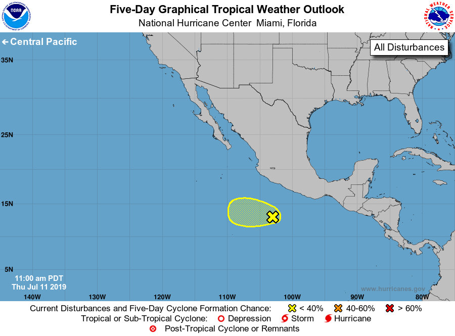
For the eastern North Pacific...east of 140 degrees west longitude:
1. A tropical wave continues to produce disorganized showers and
thunderstorms a few hundred miles south of the southwestern coast of
Mexico. Recent satellite-based wind data indicate that the surface
circulation of the disturbance is broad and poorly defined.
Environmental conditions are not expected to be conducive for
significant development during the next several days while the
system moves westward to west-northwestward well offshore the coast
of Mexico.
* Formation chance through 48 hours...low...10 percent.
* Formation chance through 5 days...low...10 percent.
Forecaster Zelinsky/Ramos