ZCZC MIATWOEP ALL
TTAA00 KNHC DDHHMM
Special Tropical Weather Outlook
NWS National Hurricane Center Miami FL
1105 AM PDT Fri Jul 5 2019
For the eastern North Pacific...east of 140 degrees west longitude:
The National Hurricane Center is issuing advisories on Tropical
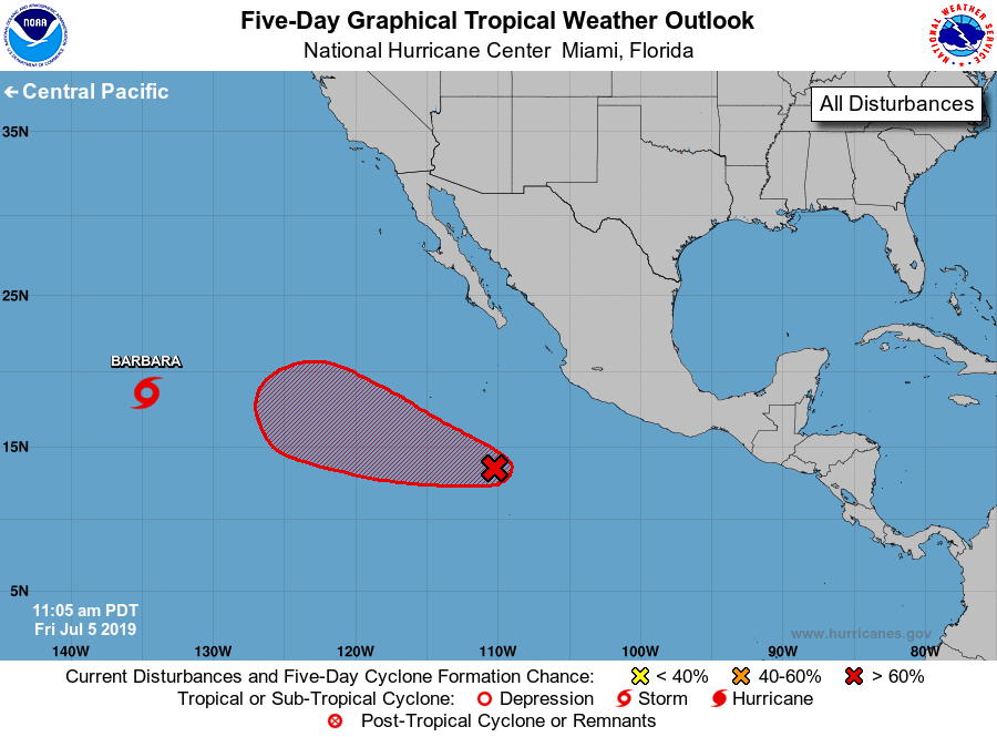
Storm Barbara, located nearly 1550 miles west of the southern tip
of the Baja California Peninsula.
1. Updated: Recent satellite data right after the Tropical Weather
Outlook was released indicate that the broad area of low pressure
several hundred miles south of the southwestern coast of Mexico is
already producing tropical storm force winds, but still lacks a
well-defined center. Environmental conditions are becoming more
conducive for development, and a tropical depression or a tropical
storm is expected to form this weekend as the system moves
west-northwestward at about 15 mph, remaining well off the coast of
Mexico.
* Formation chance through 48 hours...high...70 percent.
* Formation chance through 5 days...high...90 percent.
For more information on this system see High Seas Forecasts issued
by the National Weather Service under AWIPS header NFDHSFEPI, WMO
header FZPN02KWBC, and on the web at
ocean.weather.gov/shtml/NFDHSFEPI.php
Forecaster Avila