ZCZC MIATWOEP ALL
TTAA00 KNHC DDHHMM
Tropical Weather Outlook
NWS National Hurricane Center Miami FL
500 AM PDT Tue Jun 25 2019
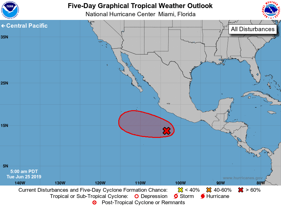
For the eastern North Pacific...east of 140 degrees west longitude:
1. Shower and thunderstorm activity associated with a broad area of low
pressure located a few hundred miles south-southeast of Manzanillo,
Mexico, is showing some signs of organization. Environmental
conditions appear to be conducive for some additional development
and this system is likely to become a tropical depression during the
next couple of days while it moves west-northwestward away from the
coast of Mexico. After that time, environmental conditions are
forecast to become less conducive for tropical cyclone formation.
* Formation chance through 48 hours...high...70 percent.
* Formation chance through 5 days...high...70 percent.
Forecaster Brown