ZCZC MIATWOEP ALL
TTAA00 KNHC DDHHMM
Tropical Weather Outlook
NWS National Hurricane Center Miami FL
1100 AM PDT Wed May 29 2019
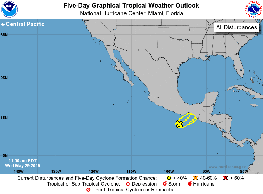
For the eastern North Pacific...east of 140 degrees west longitude:
1. An elongated area of low pressure located a couple of hundred miles
south of the southern coast of Mexico continues to produce
disorganized showers and thunderstorms. Some slow development of
this system is possible during the next couple of days before it
moves inland over southern Mexico. Regardless of whether or not
this disturbance develops, heavy rain is expected over portions of
southern Mexico and Central America throughout this week and into
the weekend. These rains could cause flash flooding and mudslides in
areas of mountainous terrain.
* Formation chance through 48 hours...low...20 percent.
* Formation chance through 5 days...low...20 percent.
Forecaster Cangialosi