ZCZC MIATWOEP ALL
TTAA00 KNHC DDHHMM
Tropical Weather Outlook
NWS National Hurricane Center Miami FL
1100 PM PDT Wed May 22 2019
For the eastern North Pacific...east of 140 degrees west longitude:
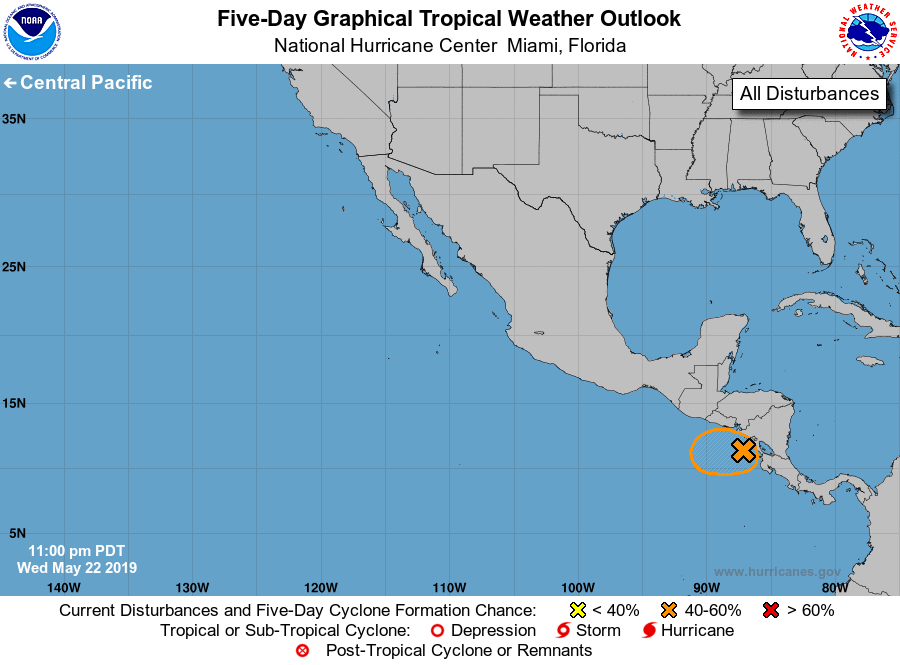
1. An area of low pressure located very near the west coast of
Nicaragua is producing widespread but disorganized showers and
thunderstorms over portions of Central America and the far eastern
North Pacific. This system is expected to meander near the
coast of Central America during the next few days, and gradual
development is possible during that time if the disturbance remains
offshore. Even if development does not occur, locally heavy rains
are likely to continue over portions of Central America during the
next few days. These rains could cause flash flooding and mudslides
in areas of mountainous terrain.
* Formation chance through 48 hours...low...30 percent.
* Formation chance through 5 days...medium...50 percent.
Forecaster Cangialosi