Skip Navigation Links
NOAA NOAA United States Department of Commerce

NHC Graphical Outlook Archive


« Earliest Available         ‹ Earlier         Later ›         Latest Available »
GIS Shapefiles
Central Pacific Eastern Pacific Atlantic

View 2-Day Graphical Tropical Weather Outlook
Click for Atlantic Click for Atlantic

Tropical Weather Outlook Text

ZCZC MIATWOEP ALL
TTAA00 KNHC DDHHMM

Tropical Weather Outlook
NWS National Hurricane Center Miami FL
1100 AM PDT Sat May 18 2019

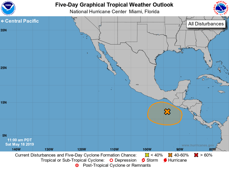
For the eastern North Pacific...east of 140 degrees west longitude:

1. A low pressure system located about 200 miles southwest of the
Mexico-Guatemala border is producing disorganized showers and
thunderstorms. Recent satellite-derived winds indicate that the
low has become better defined, and environmental conditions are
expected to somewhat conducive for slow development of this system
over the next several days while the disturbance meanders off the
coast of southeastern Mexico.
* Formation chance through 48 hours...low...10 percent.
* Formation chance through 5 days...medium...40 percent.

Forecaster Stewart


List of Atlantic Outlooks (May 2023 - present)
List of East Pacific Outlooks (May 2023 - present)
List of Central Pacific Outlooks (May 2023 - present)
List of Atlantic Outlooks (July 2014 - April 2023)
List of East Pacific Outlooks (July 2014 - April 2023)
List of Central Pacific Outlooks (June 2019 - April 2023)
List of Atlantic Outlooks (June 2009 - June 2014)
List of East Pacific Outlooks (June 2009 - June 2014)