ZCZC MIATWOEP ALL
TTAA00 KNHC DDHHMM
Tropical Weather Outlook
NWS National Hurricane Center Miami FL
400 AM PST Tue Nov 27 2018
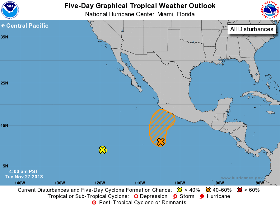
For the eastern North Pacific...east of 140 degrees west longitude:
1. A low pressure system located more than 400 hundred miles southwest
of Acapulco, Mexico, continues to produce disorganized shower and
thunderstorm activity. However, environmental conditions are
forecast to become a little more conducive for some gradual
development, and a tropical depression could form during the next
couple of days. The disturbance is forecast to move northward
today, and then turn northeastward toward southwestern Mexico on
Wednesday.
* Formation chance through 48 hours...medium...40 percent.
* Formation chance through 5 days...medium...50 percent.
2. A broad area of low pressure located about 1200 miles
south-southwest of the southern tip of the Baja California
peninsula is producing limited shower activity. Strong upper-level
winds are expected to prevent significant development of this system
during the next couple of days while it remains nearly stationary.
* Formation chance through 48 hours...low...near 0 percent.
* Formation chance through 5 days...low...near 0 percent.
Forecaster Stewart