ZCZC MIATWOEP ALL
TTAA00 KNHC DDHHMM
Tropical Weather Outlook
NWS National Hurricane Center Miami FL
400 PM PST Mon Nov 26 2018
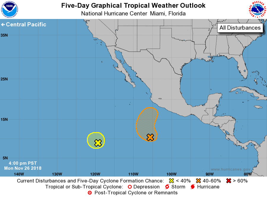
For the eastern North Pacific...east of 140 degrees west longitude:
1. A broad area of low pressure located several hundred miles southwest
of Acapulco, Mexico, continues to produce disorganized shower and
thunderstorm activity. Environmental conditions are forecast to
become conducive for some gradual development and a tropical
depression could form during the next few days. The disturbance
is currently moving slowly westward but is forecast to turn
northwestward by Tuesday, and then could turn northward or
north-northeastward later this week.
* Formation chance through 48 hours...low...30 percent.
* Formation chance through 5 days...medium...50 percent.
2. Showers and thunderstorms remain poorly organized in association
with another area of low pressure located nearly 1200 miles
south-southwest of the southern tip of the Baja California
peninsula. Strong upper-level winds are expected to prevent
significant development of this system during the next couple of
days while it remains nearly stationary.
* Formation chance through 48 hours...low...10 percent.
* Formation chance through 5 days...low...10 percent.
Forecaster Brown