ZCZC MIATWOEP ALL
TTAA00 KNHC DDHHMM
Tropical Weather Outlook
NWS National Hurricane Center Miami FL
1000 AM PST Sun Nov 4 2018
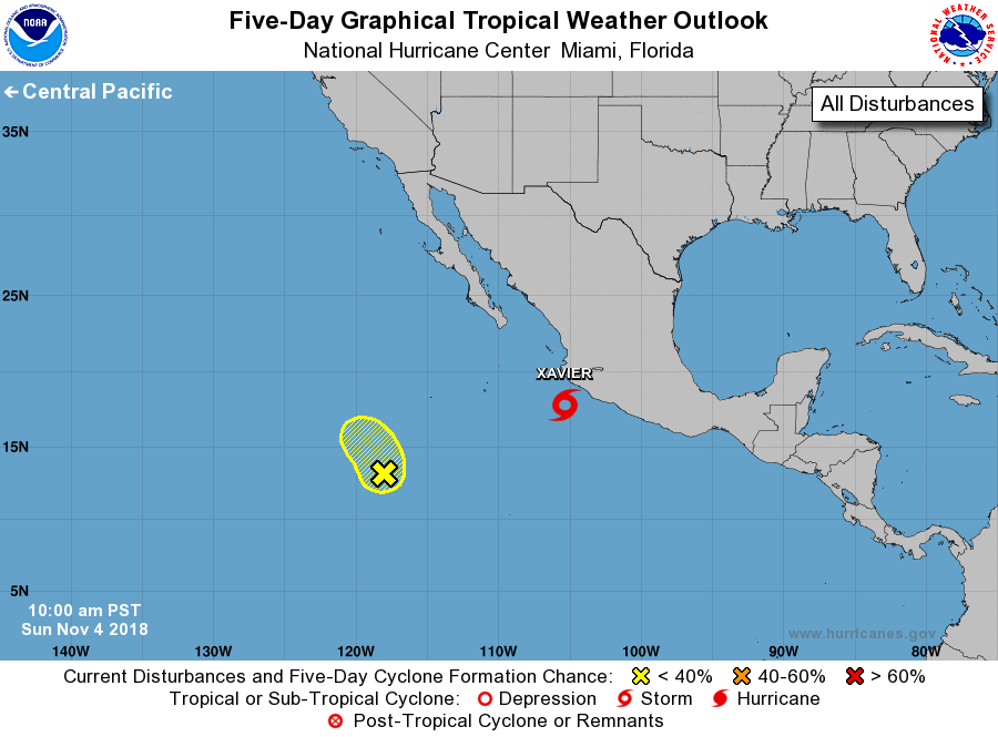
For the eastern North Pacific...east of 140 degrees west longitude:
The National Hurricane Center is issuing advisories on Tropical
Storm Xavier, located about a hundred miles south-southwest of
Manzanillo, Mexico.
1. An elongated trough of low pressure located about 850 miles
southwest of the southern tip of the Baja California peninsula is
producing disorganized showers and thunderstorms. Upper-level
winds are becoming less favorable, and significant development of
this system is not expected while it drifts northward and then
northwestward during the next couple of days.
* Formation chance through 48 hours...low...10 percent.
* Formation chance through 5 days...low...10 percent.
Forecaster Berg