ZCZC MIATWOEP ALL
TTAA00 KNHC DDHHMM
Tropical Weather Outlook
NWS National Hurricane Center Miami FL
1100 PM PDT Sat Nov 3 2018
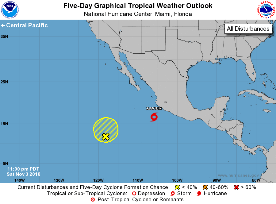
For the eastern North Pacific...east of 140 degrees west longitude:
The National Hurricane Center is issuing advisories on Tropical
Storm Xavier, located a couple of hundred miles south-southwest
of Manzanillo, Mexico.
1. An elongated trough of low pressure located about 950 miles
southwest of the southern tip of the Baja California peninsula is
producing disorganized showers and thunderstorms. Some slow
development of this system is possible during the next day or so
while it drifts northward or northeastward. Environmental conditions
are forecast to become unfavorable for further development by late
Monday or Tuesday.
* Formation chance through 48 hours...low...20 percent.
* Formation chance through 5 days...low...20 percent.
Forecaster Brown