ZCZC MIATWOEP ALL
TTAA00 KNHC DDHHMM
Tropical Weather Outlook
NWS National Hurricane Center Miami FL
500 PM PDT Thu Oct 11 2018
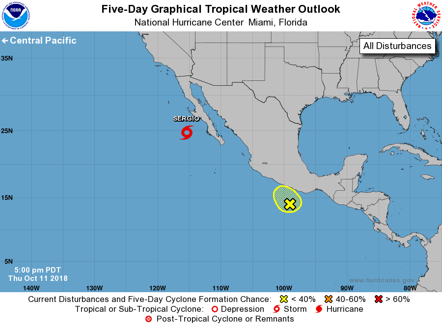
For the eastern North Pacific...east of 140 degrees west longitude:
The National Hurricane Center is issuing advisories on Tropical
Storm Sergio, located a few hundred miles west of the central
portion of the Baja California peninsula.
1. A trough of low pressure located a couple of hundred miles off the
coast of southern Mexico continues to produce disorganized showers
and thunderstorms. Some slow development of this system is possible
during the next couple of days while it moves slowly toward the
west-northwest, closer to the coast of Mexico. Further development
is unlikely after this weekend since the disturbance will be near
or over land.
* Formation chance through 48 hours...low...20 percent.
* Formation chance through 5 days...low...20 percent.
Forecaster Blake