ZCZC MIATWOEP ALL
TTAA00 KNHC DDHHMM
Tropical Weather Outlook
NWS National Hurricane Center Miami FL
500 AM PDT Fri Sep 28 2018
For the eastern North Pacific...east of 140 degrees west longitude:
The National Hurricane Center is issuing advisories on Hurricane
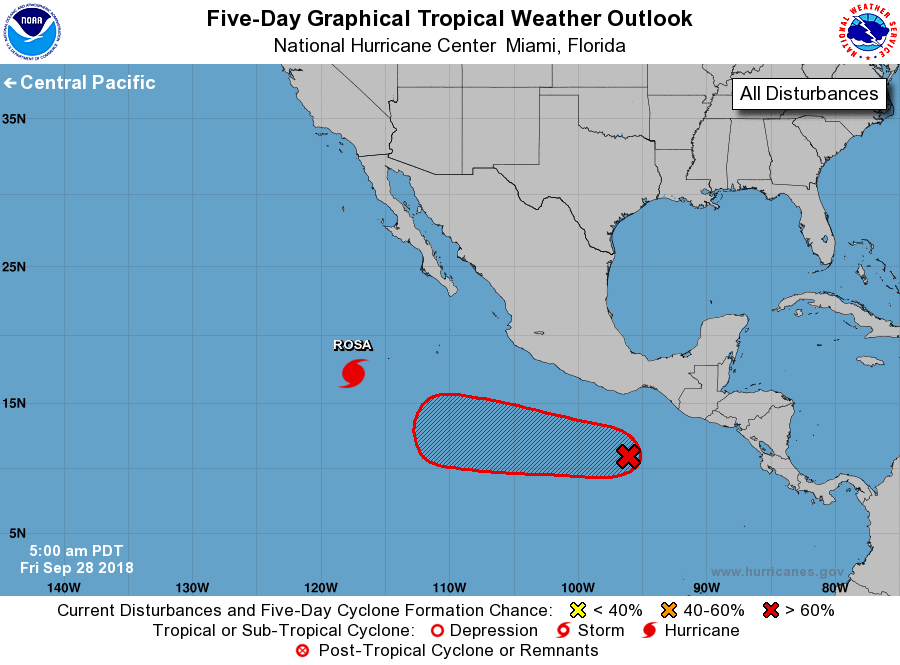
Rosa, located several hundred miles southwest of the southern tip of
the Baja California peninsula.
1. An area of low pressure centered a few hundred miles south-southwest
of the Gulf of Tehuantepec continues to gradually become better
organized. Environmental conditions are conducive for additional
development, and a tropical cyclone is expected to form over the
weekend while it moves west-northwestward well offshore of the coast
of Mexico.
* Formation chance through 48 hours...high...70 percent.
* Formation chance through 5 days...high...90 percent.
Forecaster Beven/Latto