ZCZC MIATWOEP ALL
TTAA00 KNHC DDHHMM
Tropical Weather Outlook
NWS National Hurricane Center Miami FL
1100 PM PDT Mon Sep 24 2018
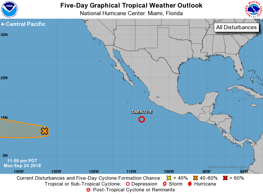
For the eastern North Pacific...east of 140 degrees west longitude:
1. Showers and thunderstorms are gradually becoming better organized
in association with a low pressure system located about 350 miles
south-southwest of Manzanillo, Mexico. Environmental conditions
appear conducive for additional development, and a tropical
depression is likely to form later today or tonight while the
system moves west-northwestward, well offshore of the coast of
Mexico.
* Formation chance through 48 hours...high...90 percent.
* Formation chance through 5 days...high...90 percent.
2. A trough of low pressure located about 1600 miles east-southeast
of Hilo, Hawaii, is producing disorganized shower activity. Some
gradual development of this system is possible through the end of
the week while it moves westward into the central Pacific.
* Formation chance through 48 hours...low...10 percent.
* Formation chance through 5 days...medium...40 percent.
Forecaster Cangialosi