ZCZC MIATWOEP ALL
TTAA00 KNHC DDHHMM
Tropical Weather Outlook
NWS National Hurricane Center Miami FL
1100 AM PDT Mon Sep 24 2018
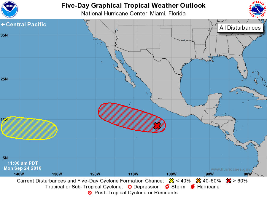
For the eastern North Pacific...east of 140 degrees west longitude:
1. Showers and thunderstorms associated with an area of low pressure
located a little over 300 miles south of Manzanillo, Mexico,
continue to become better organized and have increased in coverage
during the past several hours. Environmental conditions are
expected to be conducive for development, and a tropical depression
is likely to form within the next day or so while the system moves
west-northwestward well off the coast of Mexico.
* Formation chance through 48 hours...high...80 percent.
* Formation chance through 5 days...high...90 percent.
2. An area of low pressure is expected to form over the far western
portion of the eastern North Pacific basin in a couple of days.
Some gradual development of this system is possible after that time
while it moves westward toward the central Pacific.
* Formation chance through 48 hours...low...near 0 percent.
* Formation chance through 5 days...low...30 percent.
Forecaster Roberts