ZCZC MIATWOEP ALL
TTAA00 KNHC DDHHMM
Tropical Weather Outlook
NWS National Hurricane Center Miami FL
1100 PM PDT Thu Sep 20 2018
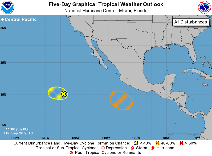
For the eastern North Pacific...east of 140 degrees west longitude:
1. A broad area of low pressure located about 1100 miles southwest of
the southern tip of the Baja California peninsula is producing
disorganized shower activity. Development, if any, of this system
will be slow to occur due to the proximity of dry air and
unfavorable upper-level winds for the next few days. This
disturbance is expected to move slowly west-northwestward at
around 10 mph during the next several days.
* Formation chance through 48 hours...low...10 percent.
* Formation chance through 5 days...low...10 percent.
2. 2. An area of low pressure is expected to form in a couple of days
well to the south of the southern coast of Mexico. Some development
is possible early next week while the system moves nearly parallel
and well offshore of the southwestern coast of Mexico.
* Formation chance through 48 hours...low...near 0 percent.
* Formation chance through 5 days...medium...40 percent.
Forecaster Stewart