ZCZC MIATWOEP ALL
TTAA00 KNHC DDHHMM
Tropical Weather Outlook
NWS National Hurricane Center Miami FL
500 PM PDT Mon Sep 17 2018
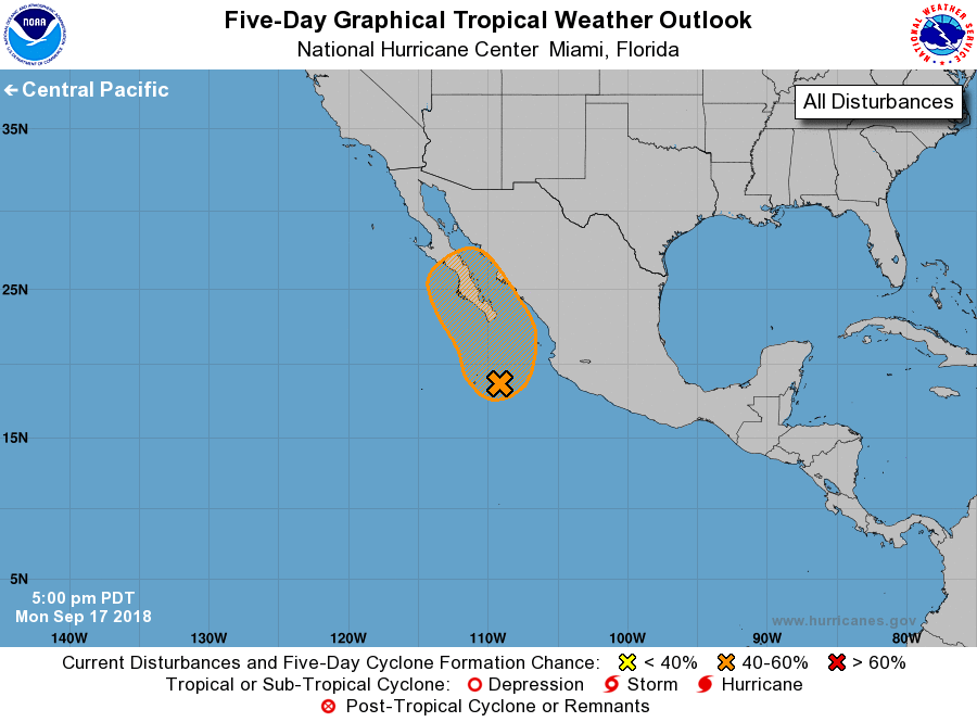
For the eastern North Pacific...east of 140 degrees west longitude:
1. A broad and elongated area of low pressure located a few hundred
miles southeast through south of the southern tip of the Baja
California peninsula continues to produce widespread but
disorganized showers and thunderstorms. Although environmental
conditions appear conducive for tropical cyclone formation, the
large size of the system and possible land interaction should
prevent any significant or rapid development from occurring during
the next day or so. However, this system could become a tropical
depression on Wednesday or Thursday as it approaches Baja California
Sur and enters the Gulf of California. Regardless of development,
this broad disturbance will likely produce very heavy rainfall over
Baja California Sur and other parts of northwestern mainland Mexico
later this week. Interests in Baja California Sur and northwestern
Mexico should monitor the progress of this disturbance.
* Formation chance through 48 hours...medium...40 percent.
* Formation chance through 5 days...high...60 percent.
Forecaster Stewart