ZCZC MIATWOEP ALL
TTAA00 KNHC DDHHMM
Tropical Weather Outlook
NWS National Hurricane Center Miami FL
1100 PM PDT Wed Sep 12 2018
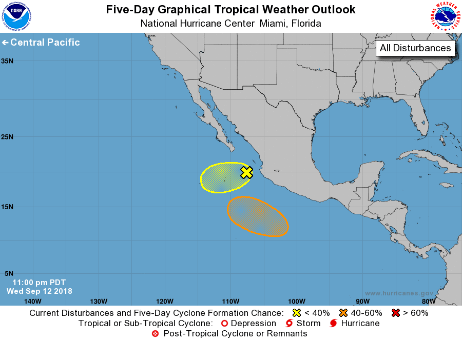
For the eastern North Pacific...east of 140 degrees west longitude:
1. A broad area of low pressure, located about 150 miles
west-southwest of Cabo Corrientes, Mexico, is producing limited
shower and thunderstorm activity. Although upper-level winds are
only marginally conducive, some development of this system is
possible over the next few days while the disturbance moves slowly
toward the west-southwest away from the coast of Mexico.
* Formation chance through 48 hours...low...20 percent.
* Formation chance through 5 days...low...30 percent.
2. An area of low pressure is expected to develop well south of the
southwestern coast of Mexico by the weekend. Thereafter,
environmental conditions appear conducive for some development, and
a tropical depression could form while the system moves generally
westward to west-northwestward south of Mexico.
* Formation chance through 48 hours...low...near 0 percent.
* Formation chance through 5 days...medium...40 percent.
Forecaster Roberts