ZCZC MIATWOEP ALL
TTAA00 KNHC DDHHMM
Tropical Weather Outlook
NWS National Hurricane Center Miami FL
1100 AM PDT Wed Sep 12 2018
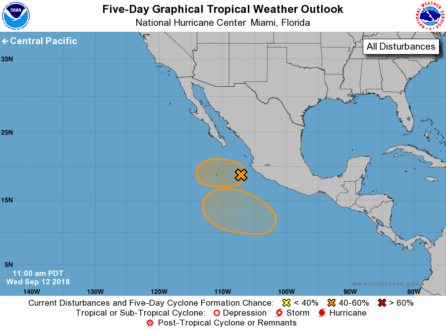
For the eastern North Pacific...east of 140 degrees west longitude:
1. Showers and thunderstorms are showing some signs of organization in
association with a trough of low pressure located a couple of
hundred miles west of southwestern Mexico. Although upper-level
winds are only marginally conducive, some development of this
system is possible over the next few days while the disturbance
moves slowly westward.
* Formation chance through 48 hours...low...30 percent.
* Formation chance through 5 days...medium...40 percent.
2. An area of low pressure is expected to develop well south of the
southwestern coast of Mexico by the weekend. Thereafter,
environmental conditions appear conducive for some development, and
a tropical depression could form while the system moves generally
westward to west-northwestward south of Mexico.
* Formation chance through 48 hours...low...near 0 percent.
* Formation chance through 5 days...medium...40 percent.
Forecaster Blake