ZCZC MIATWOEP ALL
TTAA00 KNHC DDHHMM
Tropical Weather Outlook
NWS National Hurricane Center Miami FL
1100 AM PDT Tue Aug 28 2018
For the eastern North Pacific...east of 140 degrees west longitude:
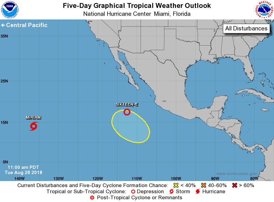
The National Hurricane Center is issuing advisories on Tropical
Storm Miriam, located more than 1000 miles east-southeast of
the Hawaiian Islands, and on recently formed Tropical Depression
Sixteen-E, located several hundred miles south-southwest of the
southern tip of the Baja California peninsula.
1. Another area of low pressure is forecast to form well southwest of
the coast of southwestern Mexico in a few days. Some gradual
development of this system is possible by the end of the week while
it moves west-northwestward or northwestward farther away from the
coast of Mexico.
* Formation chance through 48 hours...low...near 0 percent.
* Formation chance through 5 days...low...30 percent.
Public Advisories on Tropical Depression Sixteen-E are issued under
WMO header WTPZ31 KNHC and under AWIPS header MIATCPEP1.
Forecast/Advisories on Tropical Depression Sixteen-E are issued
under WMO header WTPZ21 KNHC and under AWIPS header MIATCMEP1.
Forecaster Brown