ZCZC MIATWOEP ALL
TTAA00 KNHC DDHHMM
Tropical Weather Outlook
NWS National Hurricane Center Miami FL
500 AM PDT Sun Aug 26 2018
For the eastern North Pacific...east of 140 degrees west longitude:
The National Hurricane Center is issuing advisories on newly formed
Tropical Depression Fifteen-E, located more than 1000 miles
west-southwest of the southern tip of the Baja California
peninsula.
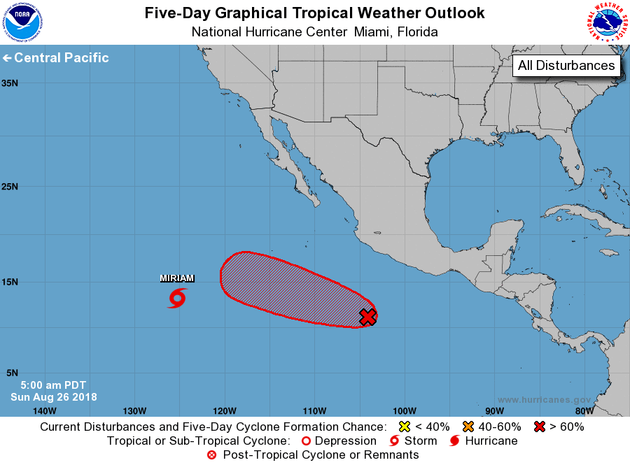
1. A broad area of low pressure located nearly 500 miles south of
Manzanillo, Mexico, is producing a large area of cloudiness and
disorganized showers and thunderstorms. Environmental conditions
are expected to be conducive for development of this disturbance
over the next several days, and a tropical depression is likely to
form by the middle of the week while the system moves westward to
west-northwestward at 10 mph.
* Formation chance through 48 hours...medium...60 percent.
* Formation chance through 5 days...high...90 percent.
Public Advisories on Tropical Depression Fifteen-E are issued under
WMO header WTPZ35 KNHC and under AWIPS header MIATCPEP5.
Forecast/Advisories on Tropical Depression Fifteen-E are issued
under WMO header WTPZ25 KNHC and under AWIPS header MIATCMEP5.
Forecaster Brown