ZCZC MIATWOEP ALL
TTAA00 KNHC DDHHMM
Tropical Weather Outlook
NWS National Hurricane Center Miami FL
1100 AM PDT Sat Aug 25 2018
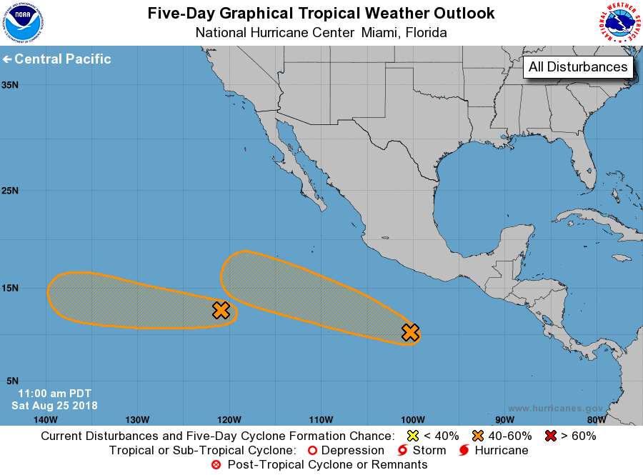
For the eastern North Pacific...east of 140 degrees west longitude:
1. An area of low pressure located about 1000 miles southwest of the
southern tip of the Baja California peninsula continues to produce
disorganized showers and thunderstorms. Environmental conditions
appear conducive for gradual development, and a tropical depression
could form within the next few days while the system moves
westward around 10 mph.
* Formation chance through 48 hours...low...20 percent.
* Formation chance through 5 days...medium...60 percent.
2. A broad low pressure system located about 500 miles south
of Acapulco, Mexico, is producing a large area of disorganized
showers and thunderstorms. Slow development of this system is
expected, and a tropical depression could form by the middle of
next week while it moves westward or west-northwestward at 10 mph.
* Formation chance through 48 hours...low...10 percent.
* Formation chance through 5 days...medium...40 percent.
Forecaster Cangialosi