ZCZC MIATWOEP ALL
TTAA00 KNHC DDHHMM
Tropical Weather Outlook
NWS National Hurricane Center Miami FL
500 AM PDT Sat Aug 25 2018
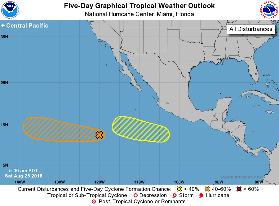
For the eastern North Pacific...east of 140 degrees west longitude:
1. Shower activity has changed little since yesterday in association
with a broad area of low pressure located about 1000 miles southwest
of the southern tip of the Baja California peninsula. Gradual
development of this system is possible during the next several days,
and a tropical depression could form by the middle of next week
while the system moves westward around 10 mph.
* Formation chance through 48 hours...low...10 percent.
* Formation chance through 5 days...medium...50 percent.
2. Another broad area of low pressure is located several hundred miles
south of Acapulco, Mexico. Some slow development of this
system is possible over the next several days while it moves
westward or west-northwestward at 10 mph.
* Formation chance through 48 hours...low...near 0 percent.
* Formation chance through 5 days...low...20 percent.
Forecaster Cangialosi