ZCZC MIATWOEP ALL
TTAA00 KNHC DDHHMM
Tropical Weather Outlook
NWS National Hurricane Center Miami FL
500 AM PDT Fri Aug 17 2018
For the eastern North Pacific...east of 140 degrees west longitude:
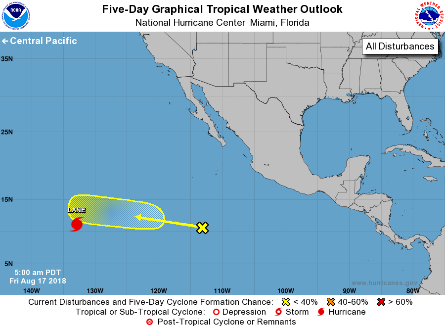
The National Hurricane Center is issuing advisories on Hurricane
Lane, located over the far southwestern portion of the eastern
North Pacific basin.
1. A tropical wave, located about 1000 miles south-southwest of the
southern tip of the Baja California peninsula, is producing
disorganized showers and thunderstorms. Some gradual development of
this system is possible during the next several days while it moves
westward to west-northwestward at 10 to 15 mph.
* Formation chance through 48 hours...low...near 0 percent.
* Formation chance through 5 days...low...20 percent.
Forecaster Roberts