ZCZC MIATWOEP ALL
TTAA00 KNHC DDHHMM
Tropical Weather Outlook
NWS National Hurricane Center Miami FL
1100 PM PDT Sun Aug 12 2018
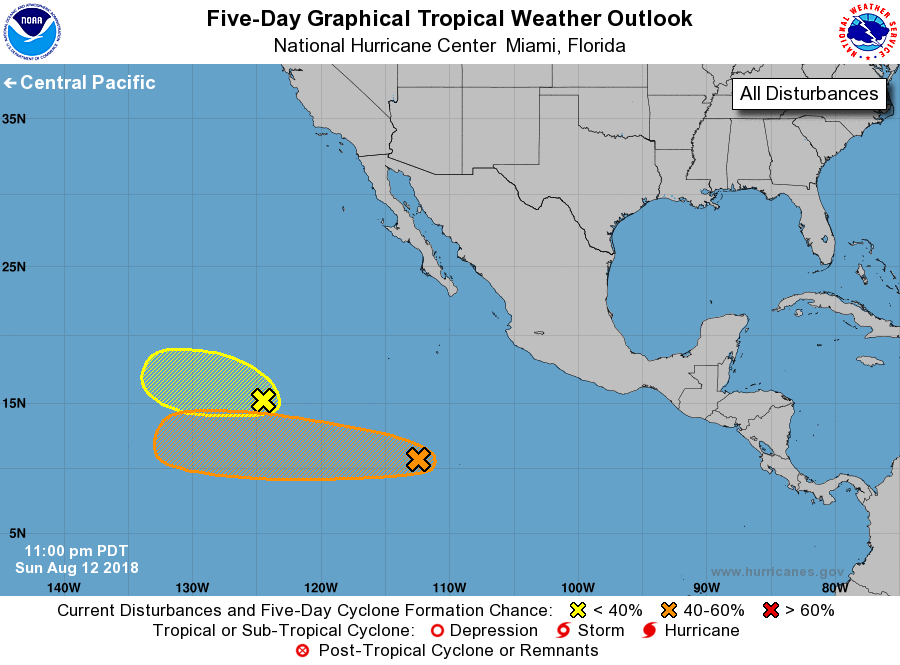
For the eastern North Pacific...east of 140 degrees west longitude:
1. Showers and thunderstorms association with a tropical wave located
about 850 miles south-southwest of the southern tip of the Baja
California peninsula remain disorganized. Environmental conditions
are forecast to become a little more conducive for development by
the middle part of the week, and a tropical depression could form
later this week while the disturbance moves westward at 10 to
15 mph.
* Formation chance through 48 hours...low...10 percent.
* Formation chance through 5 days...medium...40 percent.
2. A westward moving trough of low pressure located about 1100 miles
southwest of the southern tip of the Baja California peninsula is
producing a large area of disorganized showers and thunderstorms.
Some slow development of this system is possible during the next day
or so before upper-level winds become less conducive.
* Formation chance through 48 hours...low...10 percent.
* Formation chance through 5 days...low...10 percent.
Forecaster Brown