ZCZC MIATWOEP ALL
TTAA00 KNHC DDHHMM
Tropical Weather Outlook
NWS National Hurricane Center Miami FL
500 AM PDT Sun Aug 12 2018
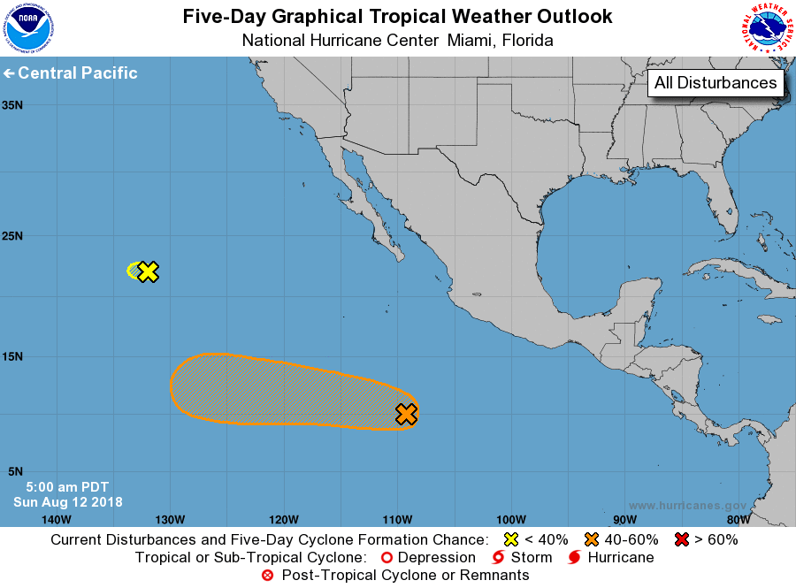
For the eastern North Pacific...east of 140 degrees west longitude:
1. A tropical wave located about 750 miles south-southwest of
Manzanillo, Mexico, continues to produce a large area of
cloudiness and disorganized shower activity. Upper-level winds
are expected to become more conducive for development by the
middle of next week, and a tropical depression could form by
that time while the disturbance moves westward farther away
from the coast of Mexico.
* Formation chance through 48 hours...low...20 percent.
* Formation chance through 5 days...medium...50 percent.
2. Limited shower activity is occurring in association with
Post-Tropical Cyclone Kristy, located about 1400 miles west of
the southern tip of the Baja California peninsula. The low is
expected to move slowly westward over colder waters, and
regeneration into a tropical cyclone is not expected.
* Formation chance through 48 hours...low...near 0 percent.
* Formation chance through 5 days...low...near 0 percent.
Forecaster Stewart