ZCZC MIATWOEP ALL
TTAA00 KNHC DDHHMM
Special Tropical Weather Outlook
NWS National Hurricane Center Miami FL
900 PM PDT Mon Aug 6 2018
For the eastern North Pacific...east of 140 degrees west longitude:
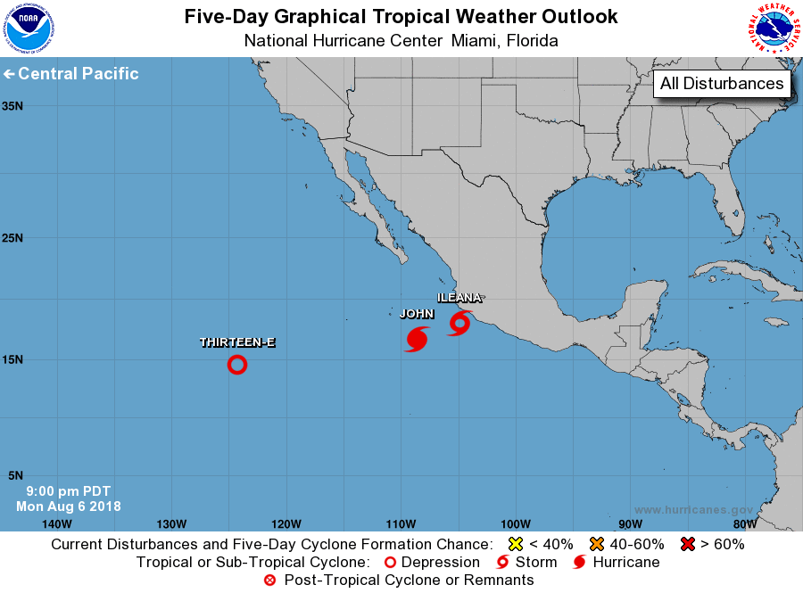
The National Hurricane Center is issuing advisories on Tropical
Storm Ileana, located a little more than a hundred miles
south-southeast of Manzanillo, Mexico, and on Hurricane John,
located a few hundred miles south-southeast of the southern tip
of the Baja California Peninsula.
1. Satellite data indicate that thunderstorm activity associated with a
well-defined low pressure system located about 1000 miles southwest
of the southern tip of the Baja California peninsula has continued
to become better organized during the past several hours, and a
special advisory package will be issued on Tropical Depression 13-E
by 1000 PM PDT.
* Formation chance through 48 hours...high...100 percent.
* Formation chance through 5 days...high...100 percent.
Forecaster Blake/Stewart