ZCZC MIATWOEP ALL
TTAA00 KNHC DDHHMM
Tropical Weather Outlook
NWS National Hurricane Center Miami FL
500 AM PDT Mon Aug 6 2018
For the eastern North Pacific...east of 140 degrees west longitude:
The National Hurricane Center is issuing advisories on Tropical
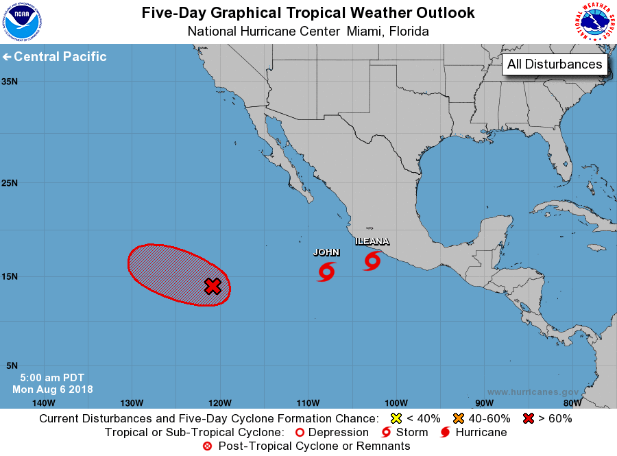
Storm Ileana, located a little more than one hundred miles
south-southwest of Acapulco, Mexico, and on Tropical Storm John,
located a few hundred miles south-southwest of Manzanillo, Mexico.
1. Showers and thunderstorms associated with an elongated area of low
pressure located about 1000 miles southwest of the southern tip of
the Baja California peninsula have increased in coverage overnight.
Environmental conditions appear conducive for development, and
a tropical depression is likely to form by the middle of the week
while the system moves west-northwestward at 5 to 10 mph.
* Formation chance through 48 hours...medium...60 percent.
* Formation chance through 5 days...high...80 percent.
Public Advisories on Tropical Storm John are issued under WMO header
WTPZ32 KNHC and under AWIPS header MIATCPEP2.
Forecast/Advisories on Tropical Storm John are issued under WMO
header WTPZ22 KNHC and under AWIPS header MIATCMEP2.
Forecaster Brown