ZCZC MIATWOEP ALL
TTAA00 KNHC DDHHMM
Tropical Weather Outlook
NWS National Hurricane Center Miami FL
1100 PM PDT Tue Jul 31 2018
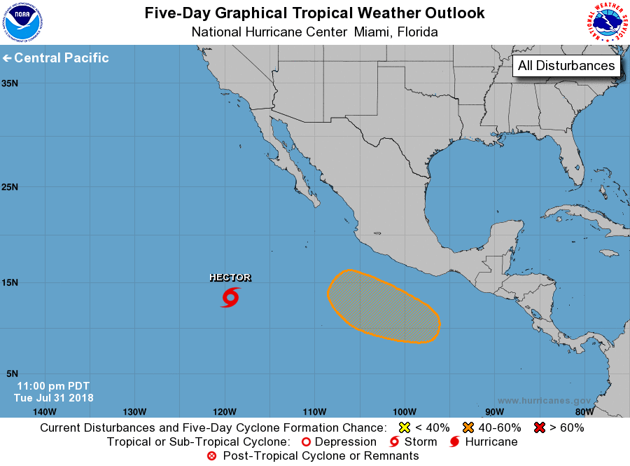
For the eastern North Pacific...east of 140 degrees west longitude:
The National Hurricane Center is issuing advisories on Tropical
Storm Hector, located more than 900 miles southwest of the southern
tip of the Baja California Peninsula.
1. An area of low pressure is expected to form several hundred miles
south or southwest of the Gulf of Tehuantepec late this week.
Environmental conditions are expected to be conducive for gradual
development of this system over the weekend while it moves
west-northwestward off the coast of Mexico.
* Formation chance through 48 hours...low...near 0 percent.
* Formation chance through 5 days...medium...50 percent.
Public Advisories on Tropical Storm Hector are issued under WMO
header WTPZ35 KNHC and under AWIPS header MIATCPEP5.
Forecast/Advisories on Tropical Storm Hector are issued under WMO
header WTPZ25 KNHC and under AWIPS header MIATCMEP5.
Forecaster Zelinsky