ZCZC MIATWOEP ALL
TTAA00 KNHC DDHHMM
Tropical Weather Outlook
NWS National Hurricane Center Miami FL
500 AM PDT Tue Jul 31 2018
For the eastern North Pacific...east of 140 degrees west longitude:
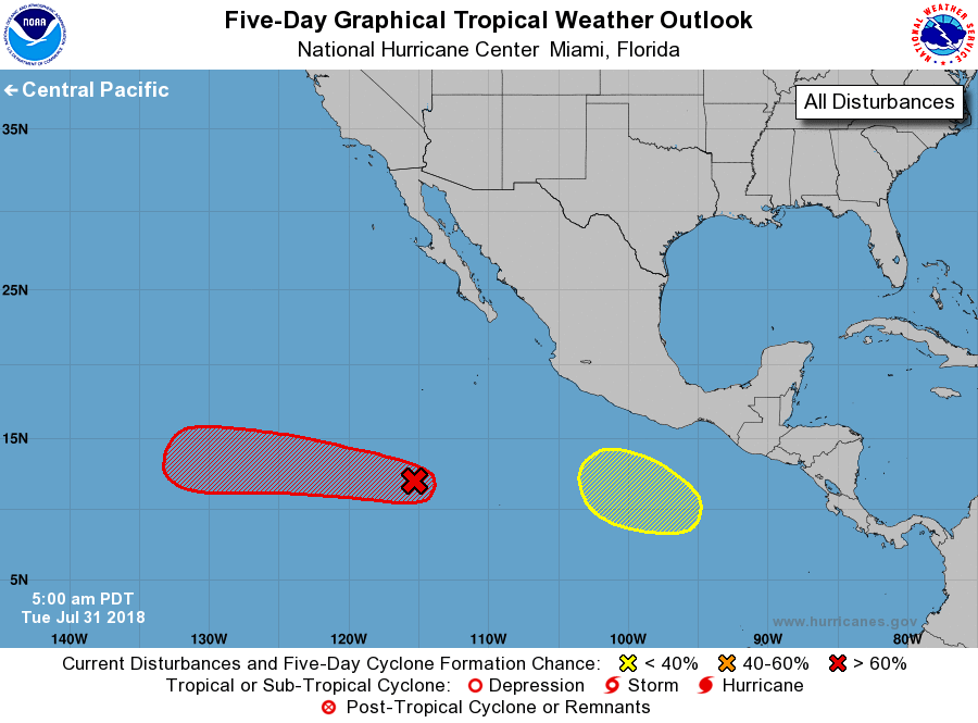
1. Showers and thunderstorms associated with an area of low pressure
located about 800 miles south-southwest of the southern tip of the
Baja California Peninsula continue to show signs of organization.
Environmental conditions appear conducive for additional
development, and a tropical depression is likely to form within
the next few days while the disturbance moves generally westward
at around 15 mph.
* Formation chance through 48 hours...medium...60 percent.
* Formation chance through 5 days...high...70 percent.
2. An area of low pressure is expected to form several hundred miles
south of the Gulf of Tehuantepec late this week. Gradual development
of this system is possible thereafter as it moves west-northwestward
off the coast of Mexico.
* Formation chance through 48 hours...low...near 0 percent.
* Formation chance through 5 days...low...30 percent.
Forecaster Stewart