ZCZC MIATWOEP ALL
TTAA00 KNHC DDHHMM
Tropical Weather Outlook
NWS National Hurricane Center Miami FL
500 AM PDT Mon Jul 30 2018
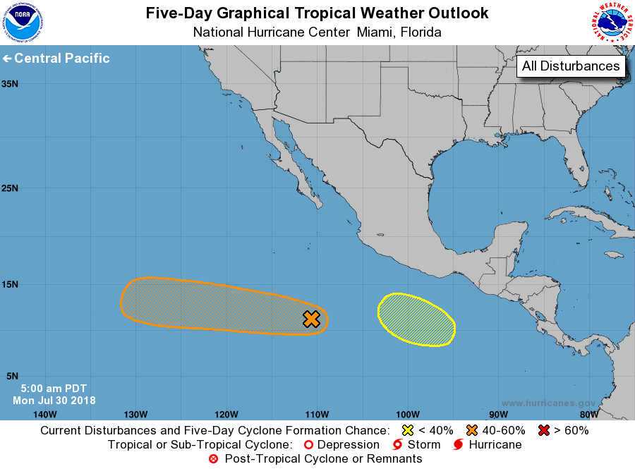
For the eastern North Pacific...east of 140 degrees west longitude:
1. A trough of low pressure located several hundred miles southwest of
Manzanillo, Mexico, is producing a small area of showers and
thunderstorms. Environmental conditions are currently only
marginally favorable and any development should be slow to
occur over the next couple of days. By mid-week, conditions could
become a little more conducive for development while the system
moves westward to west-northwestward at 10 to 15 mph.
* Formation chance through 48 hours...low...20 percent.
* Formation chance through 5 days...medium...50 percent.
2. An area of low pressure is expected to form several hundred miles
south of the Gulf of Tehuantepec late this week. Gradual development
of this system is possible thereafter as it moves west-northwestward
off the coast of Mexico.
* Formation chance through 48 hours...low...near 0 percent.
* Formation chance through 5 days...low...30 percent.
Forecaster Stewart