Skip Navigation Links
NOAA NOAA United States Department of Commerce

NHC Graphical Outlook Archive


« Earliest Available         ‹ Earlier         Later ›         Latest Available »
GIS Shapefiles
tab Eastern North Pacific tab tab Atlantic tab

View 2-Day Graphical Tropical Weather Outlook
Click for Atlantic Click for Atlantic

Tropical Weather Outlook Text

ZCZC MIATWOEP ALL
TTAA00 KNHC DDHHMM

Tropical Weather Outlook
NWS National Hurricane Center Miami FL
1100 AM PDT Tue Jul 24 2018

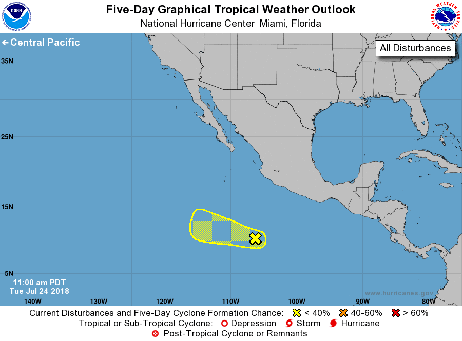
For the eastern North Pacific...east of 140 degrees west longitude:

1. A weak area of low pressure located several hundred miles
south-southwest of Manzanillo, Mexico is producing disorganized
shower activity.  No significant development is expected during the
next day or two, but conditions could become a little more favorable
for tropical cyclone formation by this weekend while the system
moves toward the west or west-northwest away from the coast of
Mexico.
* Formation chance through 48 hours...low...10 percent.
* Formation chance through 5 days...low...30 percent.

Forecaster Avila


List of Atlantic Outlooks (May 2023 - present)
List of East Pacific Outlooks (May 2023 - present)
List of Central Pacific Outlooks (May 2023 - present)
List of Atlantic Outlooks (July 2014 - April 2023)
List of East Pacific Outlooks (July 2014 - April 2023)
List of Central Pacific Outlooks (June 2019 - April 2023)
List of Atlantic Outlooks (June 2009 - June 2014)
List of East Pacific Outlooks (June 2009 - June 2014)