ZCZC MIATWOEP ALL
TTAA00 KNHC DDHHMM
Tropical Weather Outlook
NWS National Hurricane Center Miami FL
1100 PM PDT Mon Jul 23 2018
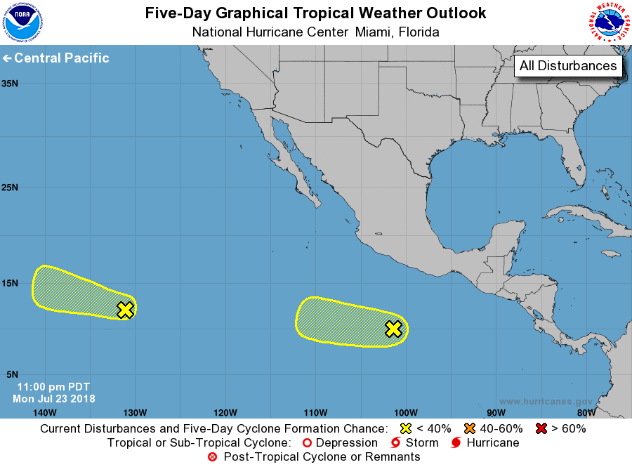
For the eastern North Pacific...east of 140 degrees west longitude:
1. A westward-moving area of disorganized thunderstorms is associated
with a small low pressure system located more than 1500 miles
southwest of the southern tip of the Baja California Peninsula.
Tropical cyclone formation is becoming less likely due to strong
upper-level winds. The system is expected to move into the Central
Pacific basin in a couple of days.
* Formation chance through 48 hours...low...10 percent.
* Formation chance through 5 days...low...20 percent.
2. A weak low pressure system is located several hundred miles
southwest of the Gulf of Tehuantepec. Associated shower activity
remains disorganized, and development, if any, should be slow to
occur during the next few days while the system moves toward
the west or west-northwest well south of the coast of Mexico.
* Formation chance through 48 hours...low...10 percent.
* Formation chance through 5 days...low...30 percent.
Forecaster Stewart