ZCZC MIATWOEP ALL
TTAA00 KNHC DDHHMM
Tropical Weather Outlook
NWS National Hurricane Center Miami FL
1100 AM PDT Mon Jul 23 2018
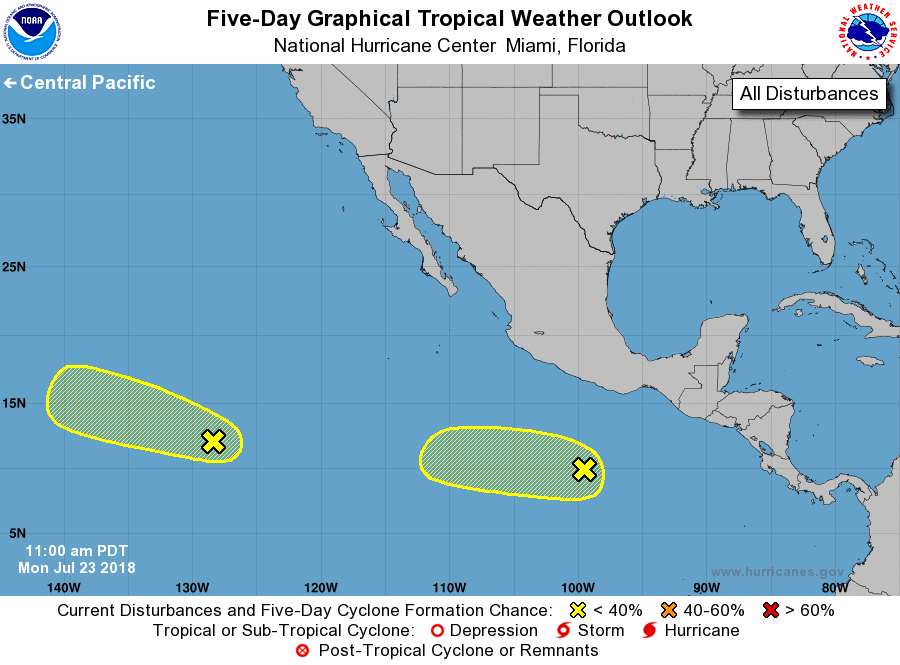
For the eastern North Pacific...east of 140 degrees west longitude:
1. A disorganized area of disturbed weather located a little more than
1450 miles southwest of the southern tip of the Baja California
Peninsula is moving westward to west-northwestward at 15 to 20 mph,
and is expected to reach the Central Pacific in a couple of days.
This system is heading toward unfavorable upper-level winds and
tropical cyclone formation is becoming less likely.
* Formation chance through 48 hours...low...10 percent.
* Formation chance through 5 days...low...30 percent.
2. A weak low pressure system is located several hundred miles
south-southwest of the Gulf of Tehuantepec. The shower activity is
currently disorganized but development, if any, will be slow to
occur during the next few days while the system moves toward the
west or west-northwest well south of the coast of Mexico.
* Formation chance through 48 hours...low...near 10 percent.
* Formation chance through 5 days...low...30 percent.
Forecaster Avila